| Name |
Year |
| Bateson, M. Toy Dealer, 82 (Victoria Road) Borough Road |
1909 |
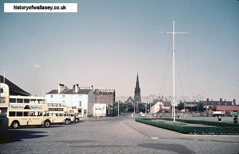
| Birkenhead Road, looking towards Seacombe Ferry |
1951 |
| Birkenhead Road, looking towards Seacombe Ferry |
1952 |
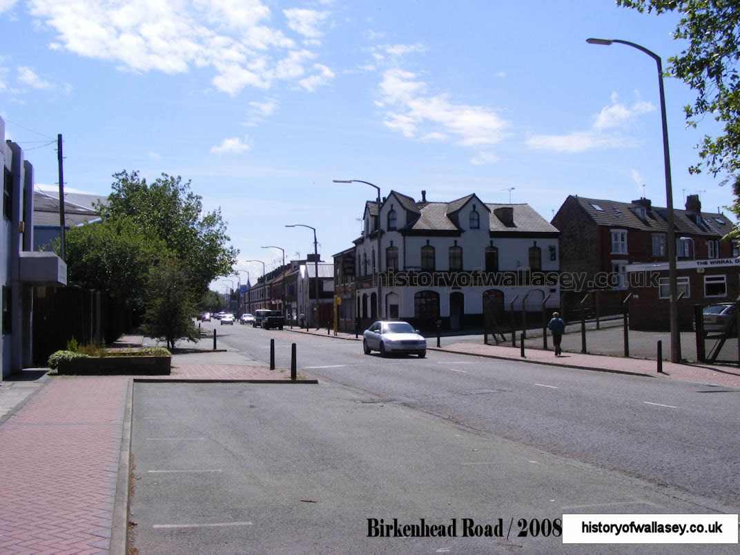
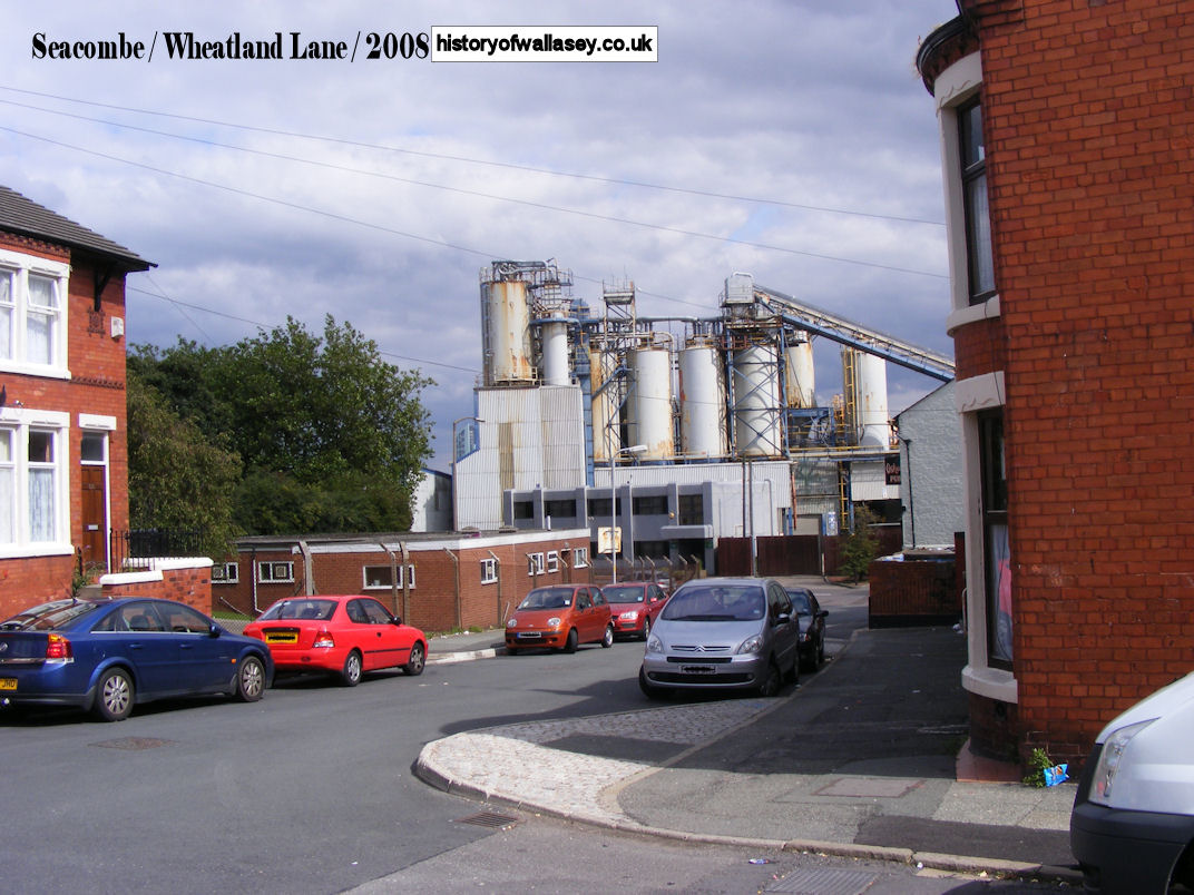
| Birkenhead Road, Wheatland Lane to the right |
2008 |
| Borough Road, map |
1909 |
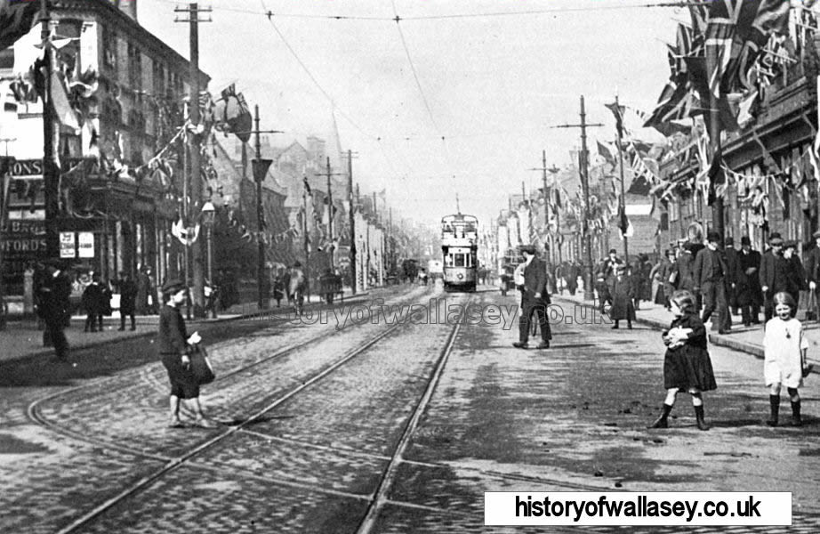
| Borough Road, at junction of Brighton Street, view towards Five Bars Rest |
c1900 |
| Borough Road |
1904 |
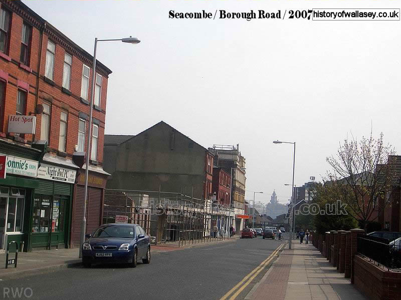
| Borough Road, looking towards Brighton Street |
2007 |
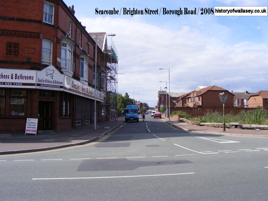
| Borough Road, from Brighton Street |
2008 |
| Borough Road, with Florence Road to the right |
1904 |
| Borough Road, with North Wales Bank on the corner |
1905 |
| Borough Road, blitz damage |
1941 |
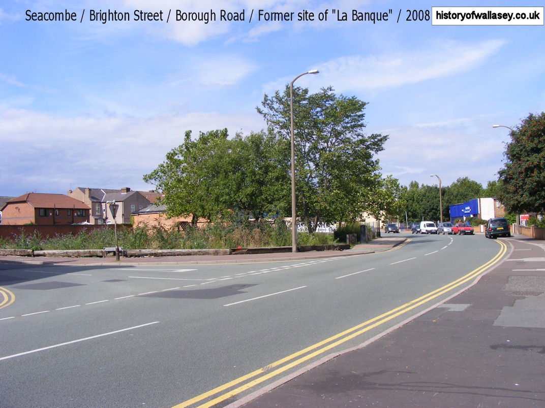
| Borough Road, view with Brighton Street junction |
1983 |
| Borough Road, with Stanley Street to the left |
1983 |
| Borough Road, workmen laying road with Five Bars Rest in the background |
1925 |
| Borough Road, looking towards Poulton Road |
1987 |
| Borough Road, looking towards Poulton Road |
1994 |
| Brighton Inn, Brighton Street |
2008 |
| Brighton Street blitz damage |
1940 |
| Brighton Street, Royal Visit |
1914 |
| Brighton Street, Rappart Street to the left |
2008 |
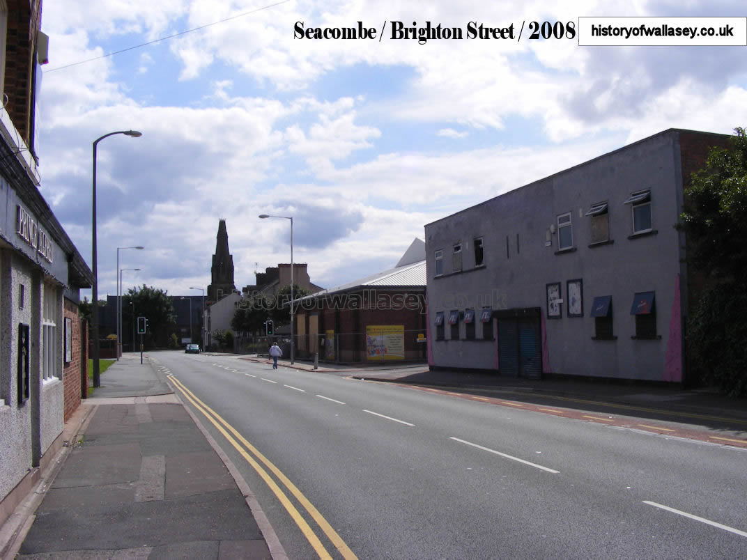
| Brighton Street, towards corner of Borough Road |
2008 |
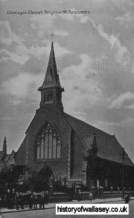
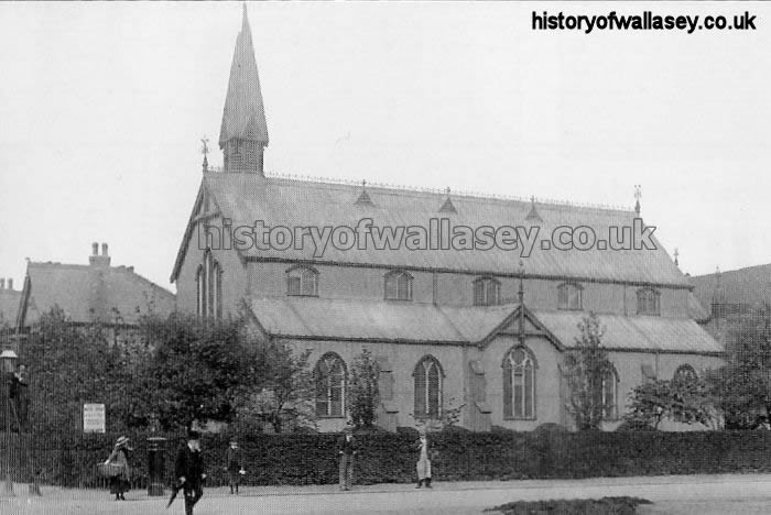
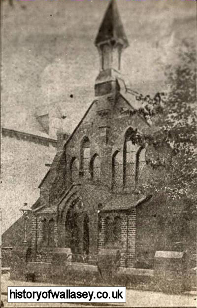
| Brighton Street Church, Brighton Street |
c1910 |
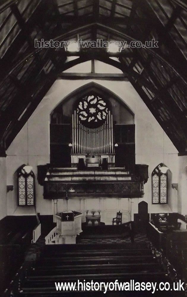
| Brighton Street Church, Brighton Street, Interior |
unknown |
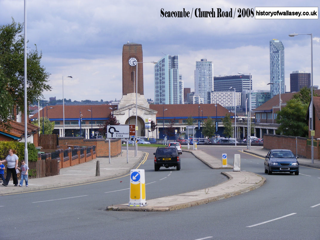
| Church Road, view towards Seacombe Ferry |
2008 |
| Church Road, view towards St. Paul's Road from Prince Alfred |
2008 |
| Church Road, view from Seacombe Ferry |
2008 |
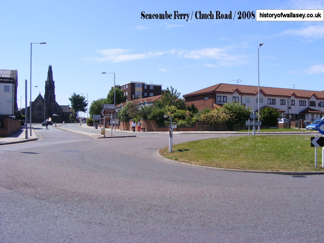
| Church Road, looking to Seacombe Ferry Terminal |
2008 |
| Church Street and Brighton Street with blitz damage to Technical School |
1941 |
| Church Street blitz damage 1 |
1941 |
| Church Street blitz damage 2 |
1941 |
| Church Street blitz damage 3 |
1941 |
| Church Street, looking towards junction of King Street |
1952 |
| Church Street, viewing a tram as it turns onto Liscard Road |
c1910 |
| Concertina Cottages, Wheatland Lane |
unknown |
| Concertina Cottages, layout |
1870s |
| Concertina Cottages, elevation plan |
1870s |
| Concertina Cottages, plan |
1870s |
| Concertina Cottages, demolishing and exposing the roof |
1954 |
| Concertina Cottages, demolishing Block E |
1954 |
| Concertina Cottages, demolishing the central flue |
1954 |
| Concertina Cottages, exposed central flue |
1954 |
| Corbyn Street, off Birkenhead Road |
2008 |
| Dale Pub. Poulton Road |
1990s |
| Demesne Street, laying tramways |
1927 |
| Demesne Street, laying first tramways |
1927 |
| E. Guest Butchers, Borough Road |
1994 |
| Eastcroft Road blitz damage |
1941 |
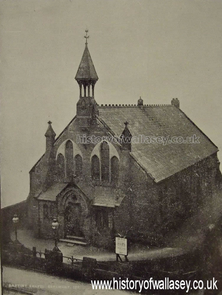
| Egremont Baptist Church, Falkland Road |
c1890 |
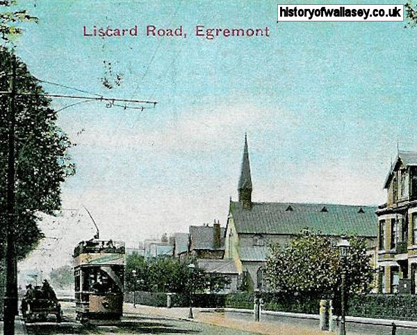
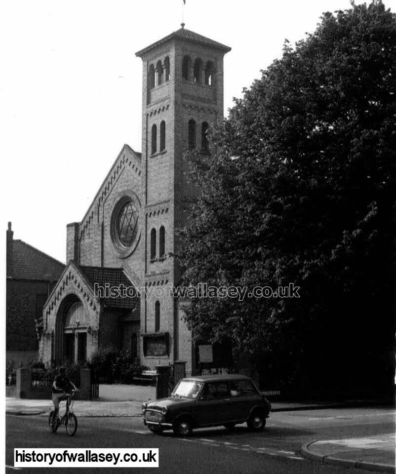
| Egremont Baptist Church, Liscard Road |
c1905 |
| Egremont Baptist Church, Liscard Road |
c1910 |
| Egremont Baptist Church, Liscard Road |
unknown |
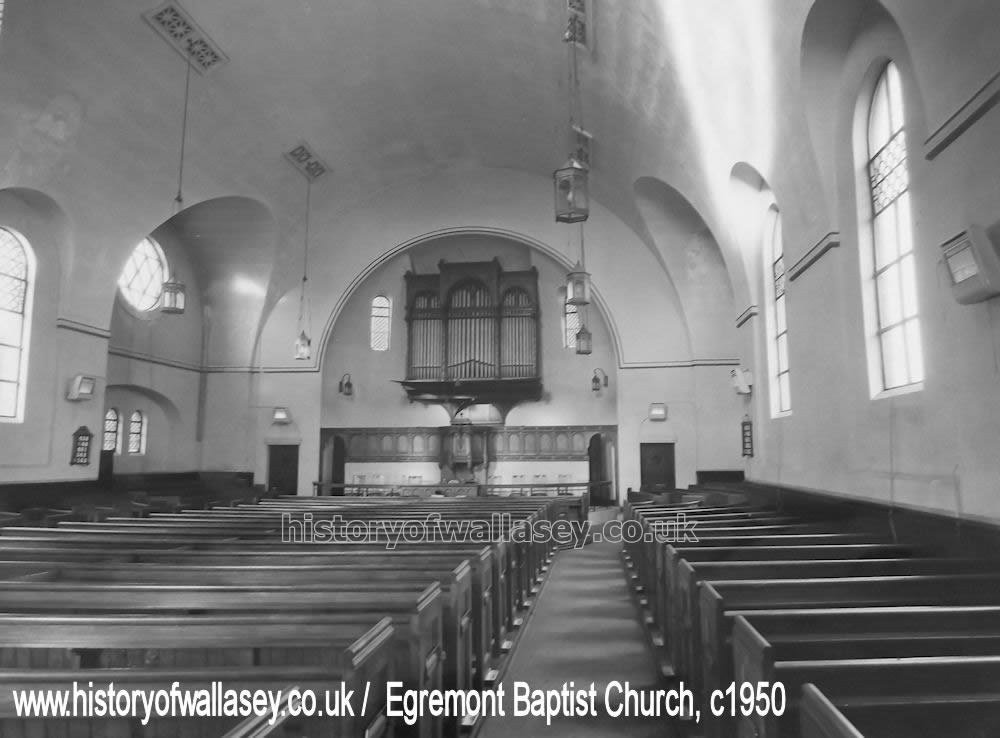
| Egremont Baptist Church, Liscard Road, interior |
c1950 |
| Egremont Presbyterian Church, King Street, front and side elevation |
c1900 |
| Egremont Presbyterian Church, King Street |
c1910 |
| Egremont Promenade, view of Town Hall |
1920s |
| Egremont, view of children and adults on the beach and ferry buildings |
1956 |
| Egremont Synagogue, Falkland Road |
c1900 |
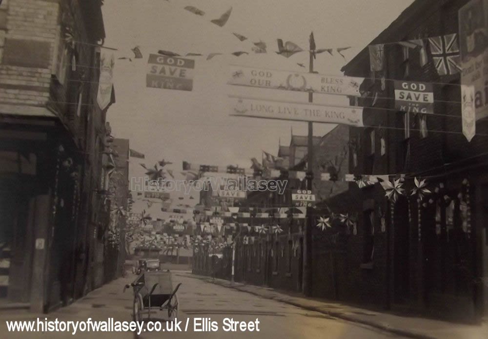
| Ellis Street, Seacombe, showing King George VI coronation celebration |
1937 |
| Erskine Road blitz damage |
1941 |
| Falkland Road, No.1, Priestley's Studio |
c1980 |
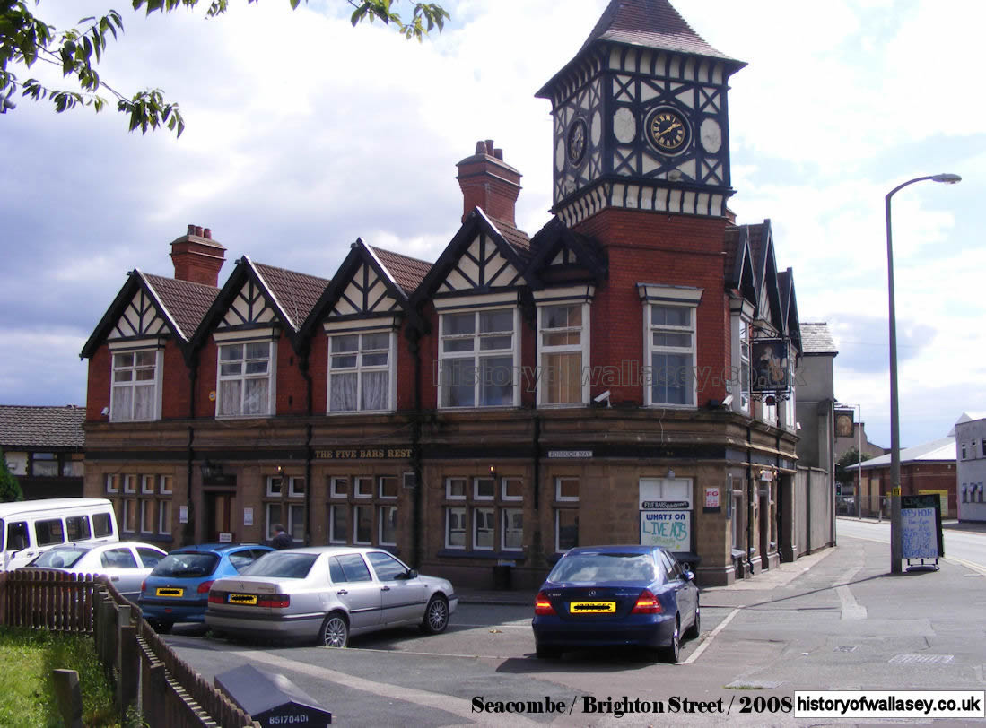
| Five Bars Rest |
2008 |
| Gandy Belt Manufacturing Co Ltd., showing their sewing department |
1907 |
| Gaumont, King Street |
1955 |
| Gaumont, King Street, interior |
1933 |
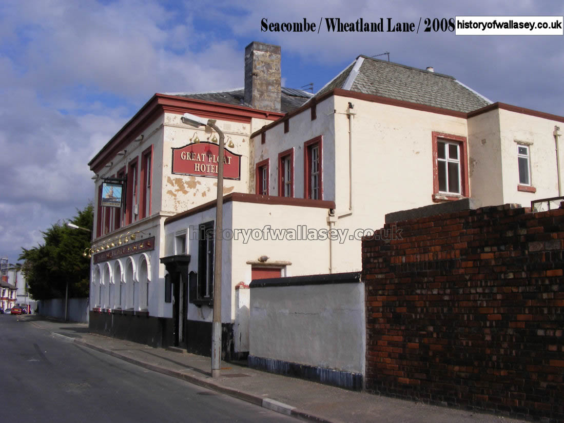
| Great Float Hotel, Wheatland Lane |
2008 |
| Guinea Gap Baths |
1945 |
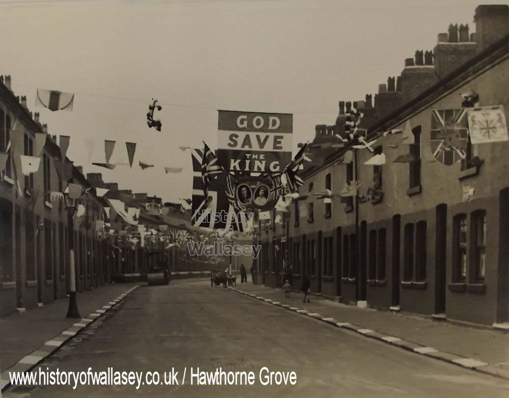
| Hawthorne Grove blitz damage to No 2, 4, 6 and 8 |
1940 |
| Hawthorne Grove, Seacombe, showing King George VI coronation celebration |
1937 |
| Hope House, Borough Road. Photograph of Hulse family in the garden |
c1885 |
| Hope House, Borough Street, map |
1899 |
| Houghton's. Toilet Saloon. 42 Borough Road |
1929 |
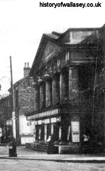
| Irving Theatre, Borough Road |
1906 |
| Kenilworth Road, Egremont, looking towards Brighton Street |
1910 |
| King Street, 'Great Britain' pub to the left and Union Street a little further on |
1954 |
| King Street, May Day Parade showing horse tramway |
1900 |
| King Street, laying tram tracks top of Tobin Street |
1901 |
| King Street, junction of Church Street, showing tram |
1902 |
| King Street, with Lyceum Electric Palace to the left and Seabank Road to the right |
c1910 |
| King Street, with Royal Cinema to the right |
c1912 |
| King Street, with Union Street to the right |
1954 |
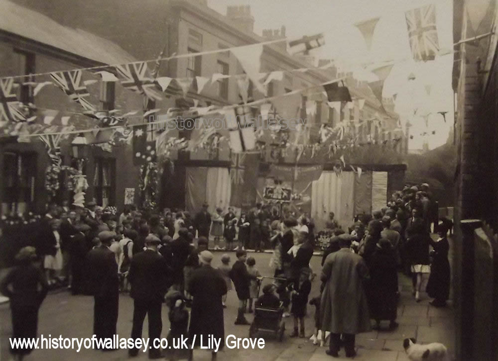
| Lily Grove, Seacombe, showing King George VI coronation celebration |
1937 |
| Liscard Road, near Walsingham Road. Presbyterian Church to the right in the background |
c1890 |
| Lyceum Electric Palace, King Street |
1920s |
| Makin's. Ironmongers. 160 (Victoria Road) Borough Road |
1911 |
| Marina Super Cinema, Brighton Street |
1916 |
| Marine Hotel, Birkenhead Road |
1951 |
| Mersey Street, showing children barefooted |
1908 |
| Mersey Street, viewed from Borough Road |
1952 |
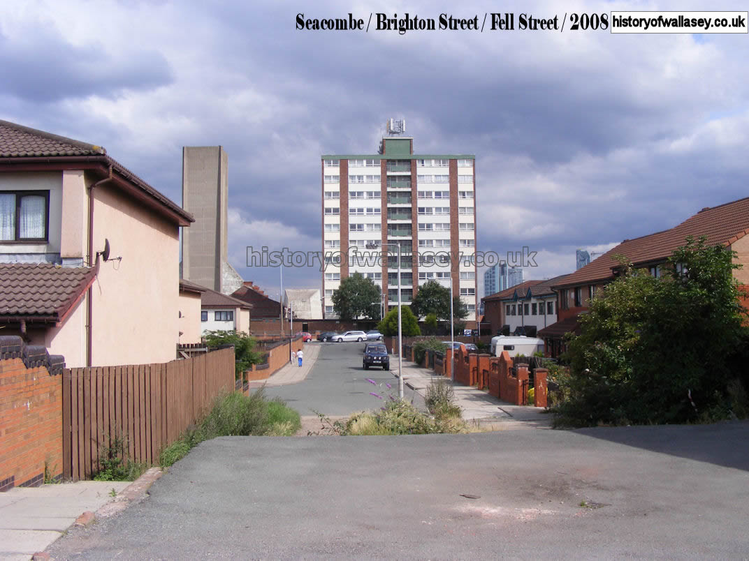
| Mersey Towers, Seacombe |
2008 |
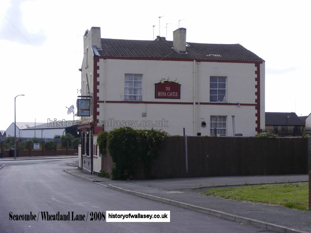
| Mona Castle, Wheatland Lane |
2008 |
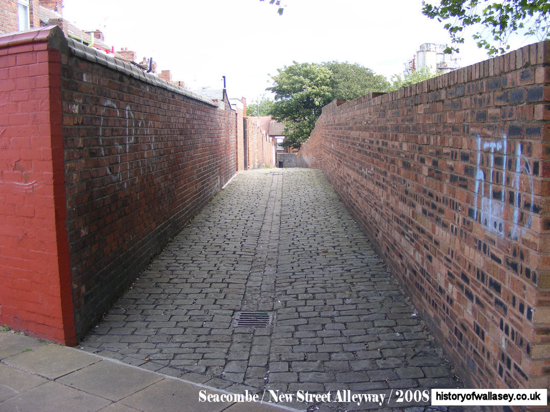
| New Street Alleyway |
2008 |
| Nickson, Isaac E. 95 (Victoria Road) Borough Road, Parcel Delivery |
1920 |
| North Meade, Egremont |
c1910 |
| North Meade, Egremont, view from river |
c1910 |
| North Meade, Egremont, map |
1875 |
| Oakdale Road, from the railway bridge |
1954 |
| Oakdale Road |
1967 |
| Old Court (Continental), Liscard Road, lying derelict |
1985 |
| Our Lady of the Seacombe and St. Joseph Church, Wheatland Lane |
c1900 |
| Our Lady of the Seacombe and St. Joseph Church, Wheatland Lane |
2007 |
| Palantine Road blitz damage |
1940 |
| Pool Inn |
c1900 |
| Percy Road, Seacombe, Woodview Avenue to the left |
c1910 |
| Poulton Hall, Poulton Hall, view from Breck Road. |
c1900 |
| Poulton Hall, Poulton Road |
c1920 |
| Poulton Hall, Poulton Road, map |
1925 |
| Poulton Manor Hall, Sherlock Lane |
c1900 |
| Poulton Manor Hall, Sherlock Lane, map |
1875 |
| Poulton Road, at Lloyds Corner |
c1900 |
| Poulton Road blitz damage to No. 218 and 220 |
1941 |
| Poulton Road, showing Ivy Cottage (No.433), near Sherlock Lane |
1906 |
| Poulton Road, with Halstead Road to the left |
1930s |
| Poulton Road, with St. Lukes Church in the distance |
1927 |
| Poulton Road, map |
1909 |
| Priestley & Sons Ltd, 1 Falkland Road, advertisement |
unknown |
| Queen's Arms, 25 Borough Road |
c1900 |
| Queen's Picture House, Poulton Road |
1948 |
| Royal, The. King Street |
1920s |
| Royal, The. King Street, interior |
1954 |
| Royal, The. King Street, advertisement |
1915 |
| Rufford Road blitz damage |
1941 |
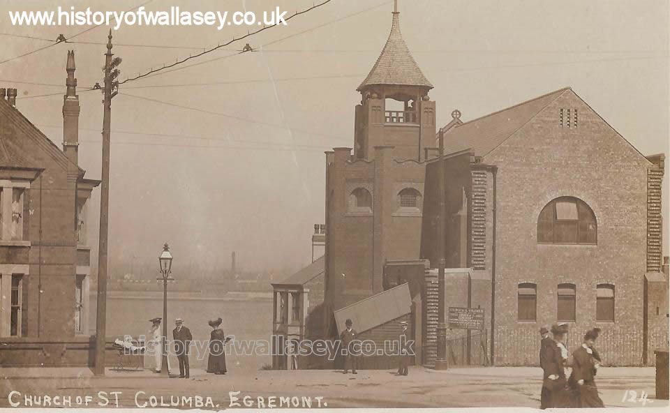
| St. Columbas Church, Trafalgar Road |
c1900 |
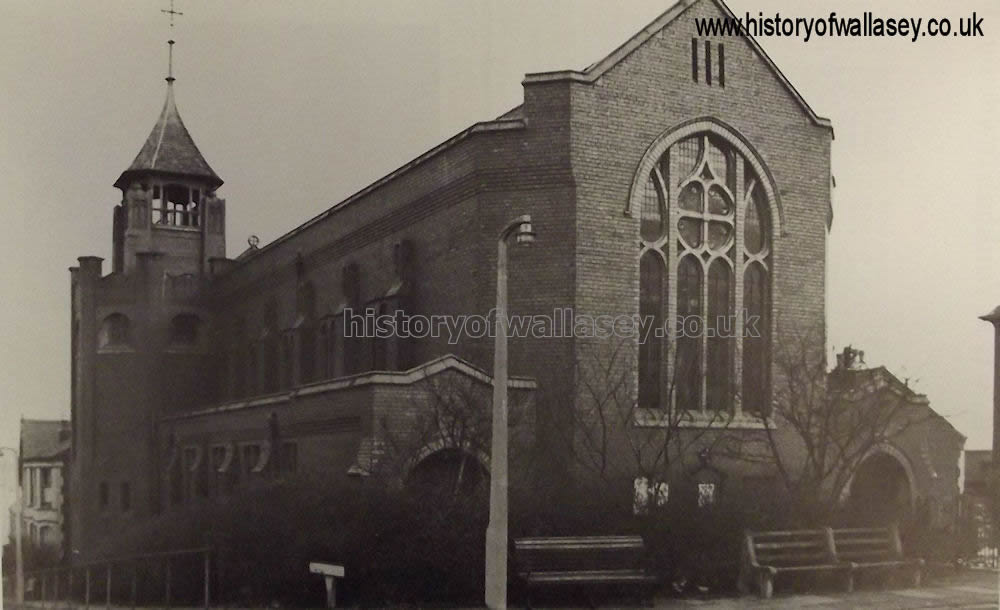
| St. Columbas Church, Trafalgar Road |
c1930 |
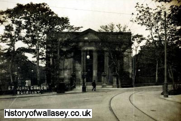
| St. John's Church, Liscard Road |
c1905 |
| St.Luke's Church, early view |
c1900 |
| St.Luke's Church |
2009 |
| St.Luke's Church, showing bomb damage after an air-raid |
1941 |
| St.Luke's Church, showing poster for last service |
2011 |
| St. Paul's Church, St. Paul's Road |
1907 |
| St. Paul's Road, painting of tram passing St. Lukes Church |
c1910 |
| St. Paul's Road, swings |
c1905 |
| St. Paul's Road, with number 18 bus passing shops |
1990 |
| Sandon Road |
1953 |
| Scott, JH. Butchers. 69-71 Borough Road (Victoria Road) |
c1908 |
| Seabank Road, thick snow covers the area at the junction of Hale Road to the right |
1936 |
| Seacombe Congregational Church, Liscard Road |
1907 |
| Seacombe Congregational Church, Liscard Road |
1950 |
| Seacombe Congregational Church, Liscard Road |
c1960 |
| Seacombe Ferry, with the running out stage extended |
1850s |
| Seacombe Ferry Hotel |
2008 |
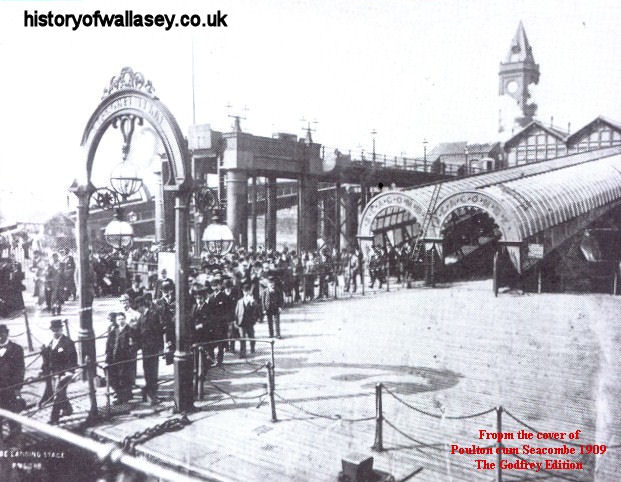
| Seacombe Ferry, landing stage |
1909 |
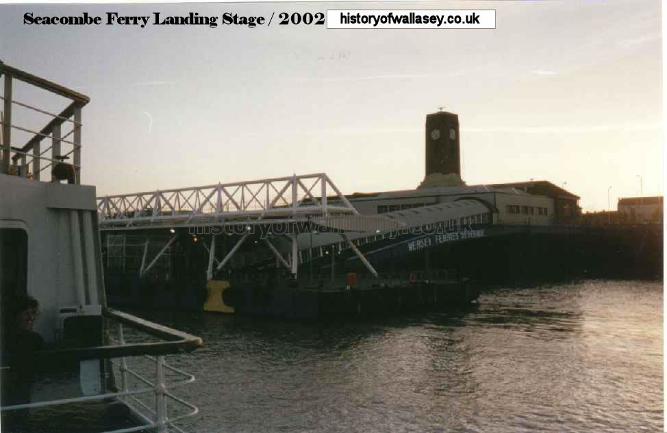
| Seacombe Ferry, landing stage |
2002 |
| Seacombe Ferry. Photograph taken before the bay was filled in 1875. |
1872 |
| Seacombe Ferry, work being carried out on filling in the bay |
1875 |
| Seacombe Ferry approach soon after opening. |
1880 |
| Seacombe Ferry, aerial view |
c1905 |
| Seacombe Ferry, aerial view |
c1940 |
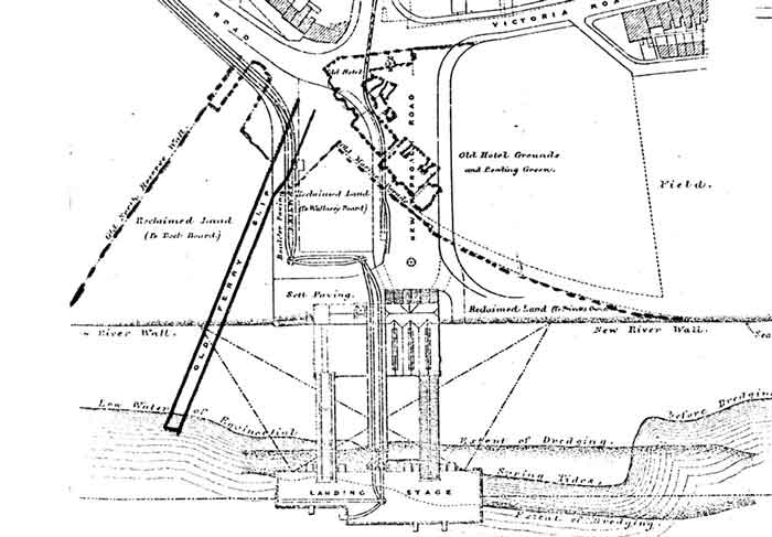
| Seacombe Ferry, map |
1871-80 |
| Seacombe Ferry, map |
1899 |
| Seacombe Ferry, Public Transport leaving |
2008 |
| Seacombe Ferry, showing line of TD1 and AEC Regent buses |
1930s |
| Seacombe Ferry, showing tram for Rake Lane route |
c1928 |
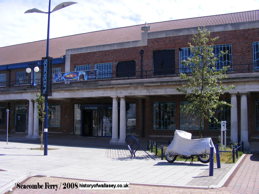
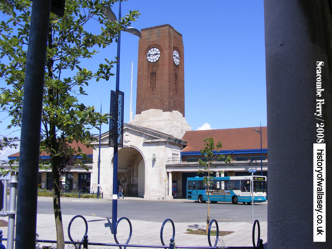
| Seacombe Ferry, Spaceport |
2008 |
| Seacombe Ferry, Terminal decorated for Royal Visit |
1932 |
| Seacombe Ferry, view of Terminal |
1932 |
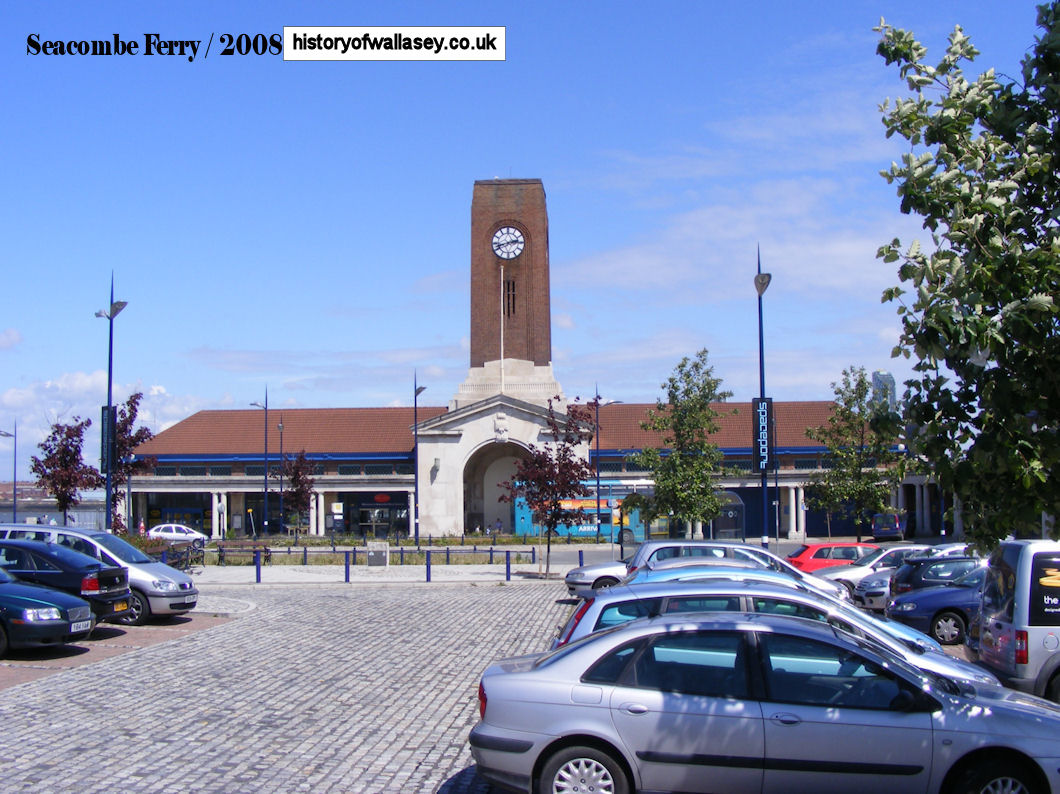
| Seacombe Ferry, view of Terminal |
2008 |
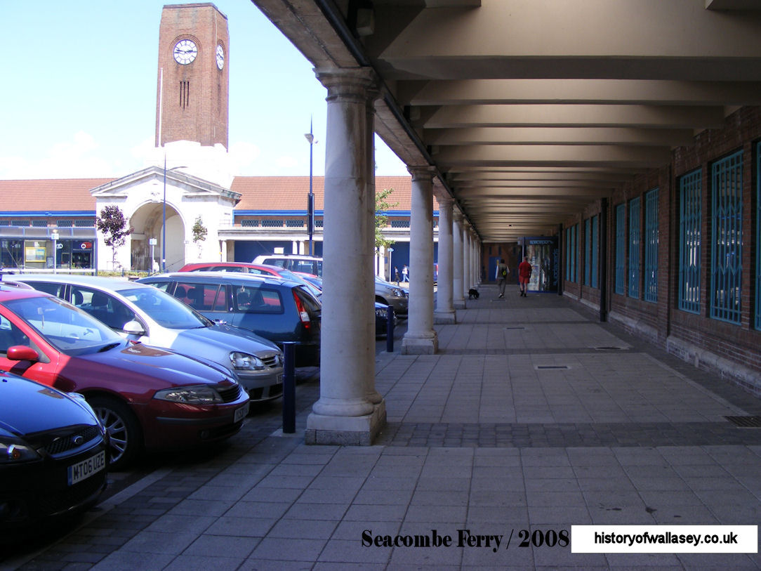
| Seacombe Ferry, view of Terminal |
2008 |
| Seacombe Ferry, Terminal, right passageway |
2008 |
| Seacombe Ferry, view towards St. Paul's Church |
c1970s |
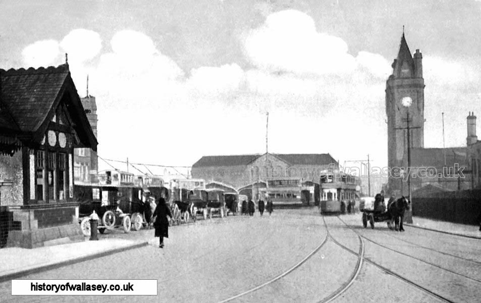
| Seacombe Ferry, Victoria Place, showing tram |
1914 |
| Seacombe Ferry, Victoria Place, showing cab shelter |
1905 |
| Seacombe Maisonettes being demolished |
1992 |
| Seacombe Ferry Municipal Garage |
1933 |
| Seacombe Presbyterian Church, Church Street |
c1950 |
| Seacombe Primitive Methodist Church, Poulton Road, after an air-raid |
1941 |
| Seacombe Recreation Grounds, Bowling Green |
unknown |
| Seacombe United Reformed Church, Brougham Road |
1950 |
| Seacombe United Reformed Church, Brougham Road, laying the stone |
1911 |
| Serpentine Road |
c1904 |
| Smithy Lane, with Borough Road in the distance |
1945 |
| Somerville House, Poulton Road |
c1900 |
| Somerville House, Poulton Road, map |
1925 |
| Stringhey Road, showing Lord Nelson pub on the corner with Trafalgar Road |
1930s |
| Titan TD1 double deck bus at Seacombe Ferry |
c1930 |
| Titan TD2 double deck bus at Seacombe Ferry |
1951 |
| Tobin Street, Prior to demolishing the Egremont Hotel |
1953 |
| Union Street |
1953 |
| Union Street, rear showing Union Street Club |
1953 |
| Victoria Place, viewing Demesne Street |
1952 |
| Vienna Hall, Brighton Street |
c1900 |
| Wallasey Town Hall |
1920 |
| Waterlily, iron paddle steamer |
c1890 |
| Welsh Presbyterian Church, drawing |
1950 |
| Wheatland Lane blitz damage |
1940 |
| Wheatland Lane, junction of Kelvin Road |
1954 |
| Wheatland Lane, looking towards Birkenhead Road |
2008 |
| Wheatland Lane, looking towards Poulton Road |
1967 |
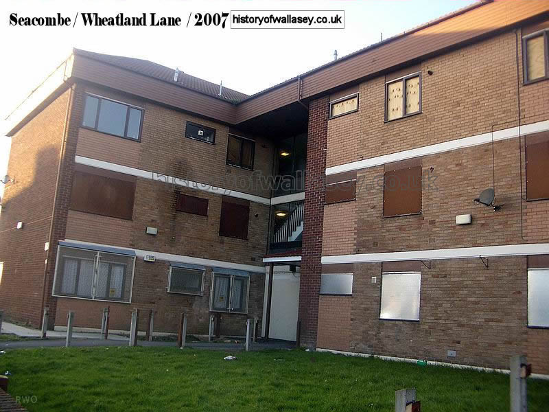
| Wheatland Lane, boarded up flats |
2006 |
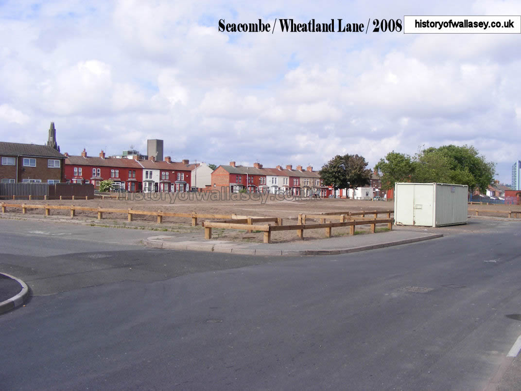
| Wheatland Lane, site of the demolished flats |
2008 |