| Name |
Year |
| Abbey Radio & Electrical Co. Radio and Television Dealers, Moreton, advertisement |
1959 |
| Asbury Road, off Green Lane, showing blitz damage |
1941 |
| Beach Cottage, Breck Road |
1950s |
| Bermuda Road, showing an undeveloped and muddy road |
1927 |
| Bidston Path with St. Hilary's and Tower in the distance. Postcard |
c1900 |
| Big Yard blitz damage |
1941 |
| Black Horse, Wallasey Village |
c1900 |
| Braddofields, Claremont Road |
1900 |
| Braddofields, Claremont Road |
1917 |
| Braddofields, Claremont Road, map |
1875 |
| Breck, The. Scene of The Breck |
unknown |
| Breck Footpath off Breck Road |
c1900 |
| Breck Place, off Breck Road |
c1900 |
| Breck Road, looking on to Wallasey Village |
1936 |
| Breck Road, map |
1875 |
| Breck Road, view from Poulton Road towards Breck Road |
1905 |
| Breck Road, view from The Breck |
1920s |
| Breck Road, looking towards Wallasey Village |
1929 |
| Breck Road, looking across potato fields towards Breck Road with terrace houses and windmill |
1880 |
| Breck Road, School House |
1886 |
| Broadway, tram enroute to Seacombe via Poulton |
1911 |
| Broadway, trams pass each other by with St. Hilary's Church in the background |
1933 |
| Broadway and trams |
unknown |
| Broadway Avenue |
1927 |
| Buxton House, Breck Road, facing west |
c1900 |
| Buxton House, Breck Road, map |
1935 |
| Buxton House Lodge, Breck Road |
unknown |
| Cheshire Cheese |
unknown |
| Cheshire Cheese, Breck Road, with thatched half-timbered shop in the foreground |
1902 |
| Cheshire Cheese, Breck Road |
1906 |
| Cheshire Cheese, painting |
c1880 |
| Cheshire Cheese (old), Breck Road |
unknown |
| Cheshire Cheese, photograph after the demolishing of the Inn and road widened. |
1900 |
| Cheshire Cheese, view of the Inn with School Lane to the left |
1925 |
| Christ Church, Moreton |
1906 |
| Christ Church, Moreton, side elevation |
c1908 |
| Church of the English Martyrs, St. George's Road, viewing construction |
1952 |
| Church of the English Martyrs, St. George's Road |
2010 |
| Church of the English Martyrs, St. George's Road |
c2005 |
| Church of the Englsih Martyrs, St. George's Road |
2010 |
| City's Caterer's Cafe, Moreton |
1920s |
| Clare Mount, Claremount Road, awaiting demolition |
1940s |
| Clare Mount School, Claremount Road, advertisement |
1865 |
| Clare Mount, Claremount Road, map |
1935 |
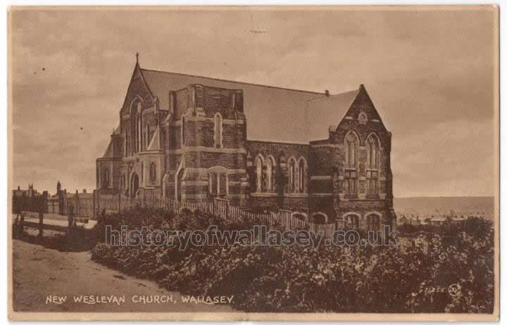
| Claremount Methodist Church, Claremount Road. Postcard |
c1910 |
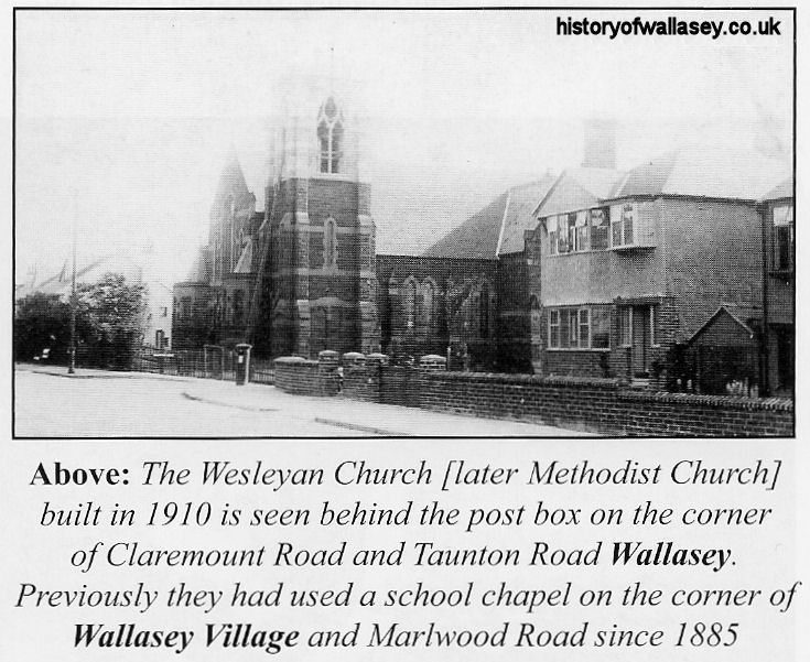
| Claremount Methodist Church, Claremount Road |
c1910 |
| Claremount Methodist Church, Claremount Road |
2010 |
| Claremount Road |
c1900 |
| Claremount Road at the junction of Broadway looking North |
c1900 |
| Claremount Road, with Broadway to the left |
1927 |
| Claremount Road, with Clare Lodge to the right and St. Hilary's in the distance |
1925 |
| Claremont Road, viewed from Grove Road |
1912 |
| Coach & Horses, Moreton |
1928 |
| Coach & Horses, Moreton, advertisement |
1910 |
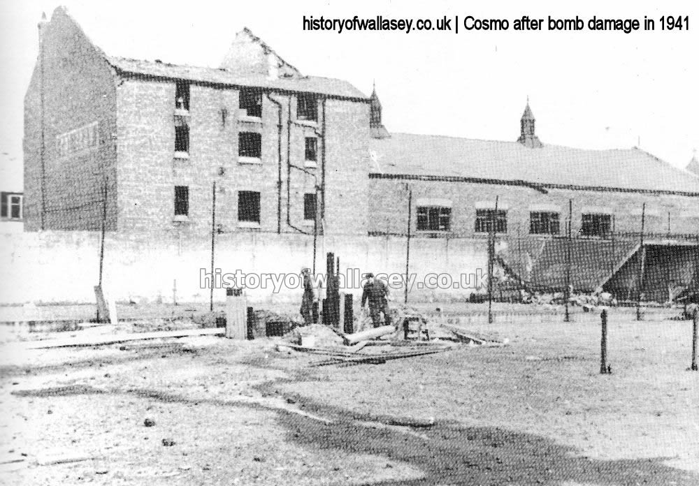
| Coliseum (originally Cosmo), Wallasey Village, bomb damage after air raid |
1941 |
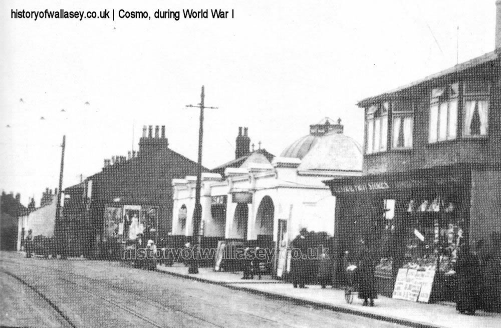
| Cosmo Cinema, Wallasey Village |
c1916 |
| Cosmo Cinema, Wallasey Village, advertisement |
1913 |
| Cushing, F.B & Son. Hardware, Moreton Cross, advertisement |
1959 |
| Darley Dene, Breck Road |
c1900 |
| Darley Dene, Breck Road, showing carriage and horse |
1895 |
| Darley Dene, Breck Road, map |
1926 |
| Dean, Samuel. with family and market gardeners |
unknown |
| Egremont Ferry, original |
unknown |
| Elms, The. Saughall Massie |
c1900 |
| Farmers Arms, Moreton |
1920 |
| Folly Lane and the Cottages. Postcard |
c1900 |
| Green Lane |
1952 |
| Grove Hotel, Wallasey Village. Postcard |
1914 |
| Grove Roaf junction with Wallasey Village showing war damage |
1941 |
| Grove Road, showing tramlines |
unknown |
| Grove Road, trams at Warren Drive junction |
1929 |
| Grove Road, tram passing Harrison Drive junction |
1933 |
| Grove Road, view from Wallasey Village |
c1900 |
| Gulley, The. Off Broadway |
c1890 |
| H.F Radio & Electrical Supplies, 169 Wallasey Village, advertisement |
1922 |
| Harrison Drive |
c1910 |
| Harrison Drive |
1937 |
| Harrison Drive and the sand dunes |
c1905 |
| Harrison Drive, tram rounds the corner |
1922 |
| Hawkins & Hunter, 125 Wallasey Village, advertisement |
1930 |
| Heathbank, Breck Road, front entrance |
1970s |
| Heathbank, Breck Road, map |
1926 |
| Hose Side House, Hose Side Road |
c1900 |
| Hose Side House, Hose Side Road, map |
1899 |
| Hose Side House, Hose Side Road, map |
1935 |
| Hoylake Road, looking towards Moreton Cross with the old Coach & Horses to the left |
c1906 |
| Hoylake Road, looking down towards Moreton Cross |
1927 |
| Hoylake Road, Roslyn Drive to right of bus with Lunts on the corner |
1929 |
| Irwins, on the corner of Wallasey Village and Leasowe Road |
1930s |
| Ivy Cottage, Saughall Massie |
1910 |
| Ivy Cottage, Saughall Massie, close view |
c1910 |
| Kerrs Field, Moreton, showing makeshift homes |
1925 |
| Langdale Road blitz damage |
1940 |
| Lawton's Farm, Wallasey Village |
1894 |
| Lawton's Farm, Wallasey Village, view from Leasowe Road |
1902 |
| Laund, The. Claremount Road |
c1910 |
| Laund, The. Claremont Road, map |
2000 |
| Leasowe Castle, Leasowe Road |
1905 |
| Leasowe Castle, Leasowe Road |
c1910 |
| Leasowe Castle Buffet, corner of Reeds Lane and Leasowe Road |
unknown |
| Leasowe Hospital, Leasowe Road |
unknown |
| Leasowe Road |
1900 |
| Leasowe Road |
1912 |
| Leasowe Road |
1920s |
| Leasowe Road, map |
1875 |
| Leasowe Road, map |
1898 |
| Leasowe Road, view of St. John's Road |
1930s |
| Leasowe Road, with No.2 and No.4 on the right and the gates of Spragg Vale Brewer on the left |
1913 |
| Leasowe Road, with Spraggs Vale Brewer |
1917 |
| Leyburn Road blitz damage |
1941 |
| Lighthouse Inn, Wallasey Village |
1898 |
| Lighthouse Inn, Wallasey Village, advertisement |
1908 |
| Millthwaite, The Breck |
c1910 |
| Millthwaite, The Breck |
c1900 |
| Millthwaite, The Breck, map |
1935 |
| Mary Ann's Lane, Moreton |
c1900 |
| Moreton Baptist Church, Hoylake Road, Moreton |
c1930 |
| Moreton Baptist Church, Hoylake Road, Moreton |
1959 |
| Moreton Brick & Tile Co. Ltd. Moreton, advertisement |
1920 |
| Moreton Cross. Moreton |
1931 |
| Moreton Cross, Moreton, showing newly opened Coach & Horses |
1933 |
| Moreton Cross, Moreton, showing new roundabout |
1935 |
| Moreton Cross, Moreton |
1936 |
| Moreton Cross, Moreton, showing completed roundabout |
1937 |
| Moreton Cross, Moreton, with Pasture Road in distance |
1959 |
| Moreton Picture House, Pasture Road |
1920s |
| Moreton Presbyterian Church, Hoylake Road, Moreton |
c2005 |
| Mosslands, off Breck Road, showing front entrance |
c1910 |
| Mosslands, off Breck Road, map |
1926 |
| Our Lady of Lordes, Leasowe |
c2005 |
| Pasture Road, Moreton, with coal cart outside 'Sunny Side' |
1910 |
| Phoenix Cinema, Wallasey Village |
1951 |
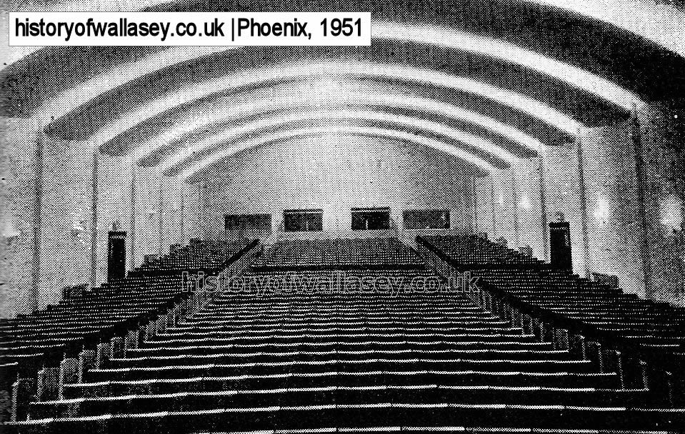
| Phoenix Cinema, Wallasey Village, interior |
1951 |
| Plough Inn, Breck Road |
c1910 |
| Plough Inn and Druids Arms, Birkenhead Road, Moreton |
1905 |
| Ring O Bells, Wallasey Village, with School Lane to the left |
c1900 |
| Rosebank, Grove Bank |
unknown |
| Royal Oak Inn, Wallasey Village |
1894 |
| Sacred Heart Roman Church, Hoylake Road, Moreton |
1957 |
| Sacred Heart Roman Church, Hoylake Road, Moreton, side elevation 1 |
1957 |
| Sacred Heart Roman Church, Hoylake Road, Moreton, side elevation 2 |
1957 |
| Sacred Heart Roman Church, Hoylake Road, Moreton, opening brochure |
1957 |
| Sacred Heart Roman Church, Hoylake Road, Moreton, The Pulpit |
1957 |
| Sacred Heart Roman Church, Hoylake Road, Moreton, The Sanctuary |
1957 |
| Sandy Lane, showing Clare Mount House |
c1900 |
| Sandcliffe Road (then known as Jockey Lane) |
c1900 |
| Saughall Massie Bridge |
c1900 |
| School Lane, originally called Nelson's Gutter |
c1900 |
| School Lane, Wallasey Village |
c1900 |
| Sebastopol Inn, Breck Road |
1920 |
| Spragg Farm, Wallasey Village |
c1910 |
| St. Chad's, Twickenham Drive, Leasowe |
c1950 |
| St. Chad's. Twickenham Drive, Leasowe |
c2000 |
| St. George's Elementary. St. George's Road |
1898 |
| St. George's Road |
c1906 |
| St. George's School from Folly Lane |
1907 |
| St. Hilary, Grove Road |
1908 |
| St. Hilary Brow |
c1900 |
| St. Hilary Brow |
c1905 |
| St. Hilary Brow |
1925 |
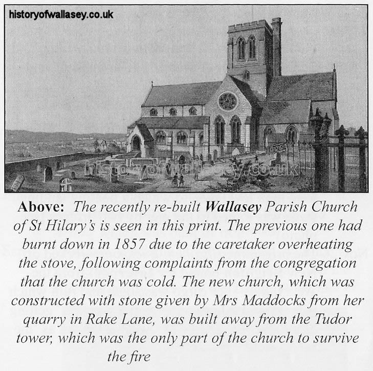
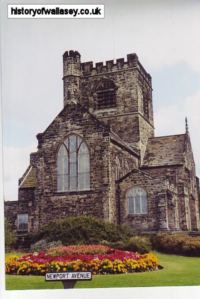
| St. Hilary's Church |
1850 |
| St. Hilary's Church, painting |
c1850 |
| St. Hilary's Church. A Merry Xmas Postcard |
c1905 |
| St. Hilary's Church. Postcard |
c1900 |
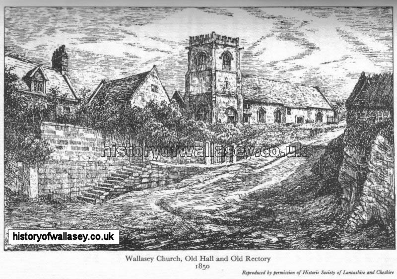
| St. Hilary's Church, Old Hall and Old Rectory drawing |
1850 |
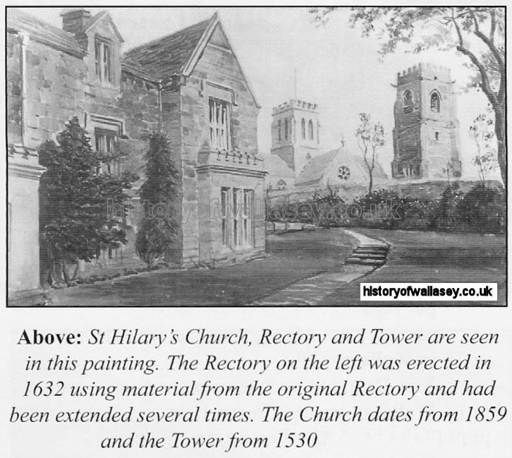
| St. Hilary's Church, Rectory and Tower |
c1913 |
| St. Hilary's Church, side elevation |
2008 |
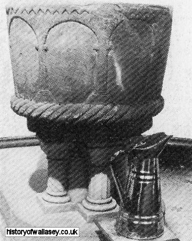
| St. Hilary's Church, font |
unknown |
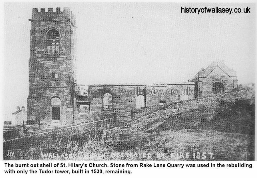
| St. Hilary's Church, burnt out remains |
1857 |
| St. Hilary's Church, newly burnt |
1868 |
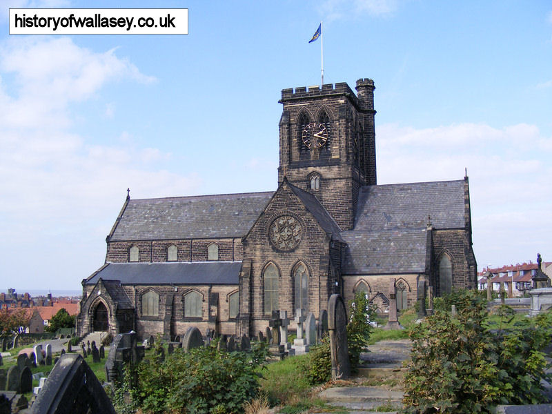
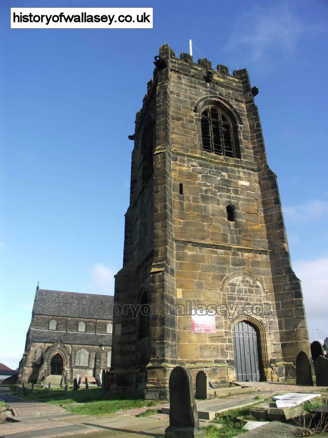
| St. Hilary's Church, tower |
c2006 |
| St. Hilary's Church and Tower |
1967 |
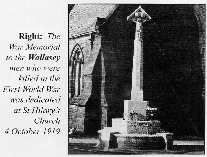
| St. Hilary's Church, war memorial |
1919 |
| St. Hilary's Parish Hall |
1990s |
| St. Nicholas Church, Bayswater Road |
1911 |
| St. Nicholas Church, Bayswater Road |
c2000 |
| Travellers Rest. Wallasey Village |
1930s |
| Travellers Rest, 162 Wallasey Village, advertisement |
1918 |
| Turner, Muriel, Ladies Underwear and Hosiery, 100 Wallasey Village, advertisement |
1927 |
| Twenty Row, Leasowe Road |
1957 |
| Village, The. 259, 261 275 Wallasey Village, advertisement |
1922 |
| Wallasey Club House |
c1906 |
| Wallasey Cottage Hospital. Claremount Road |
1915 |
| Wallasey Grammar School |
1870 |
| Wallasey Grange, Grove Road |
unknown |
| Wallasey Grange, Grove Road, map |
1935 |
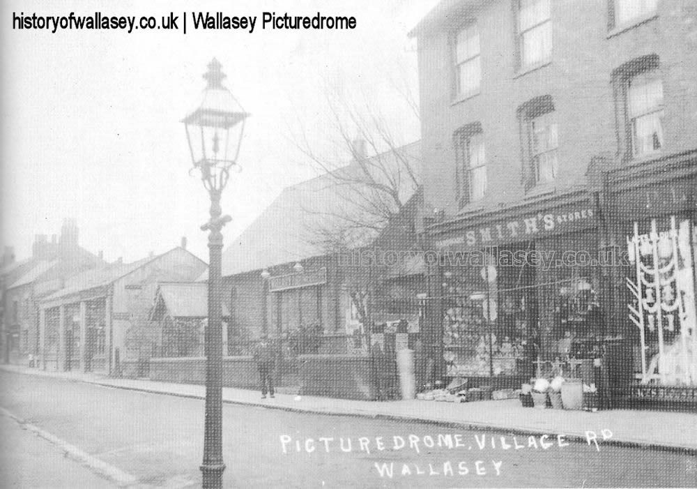
| Wallasey Picturedome, Wallasey Village |
c1911 |
| Wallasey School |
1910 |
| Wallasey Village, at the junction of Folly Lane (later this section was renamed as Broadway) |
1905 |
| Wallasey Village, at the junction of Leasowe Road |
1909 |
| Wallasey Village, at the junction of Leasowe Road |
1923 |
| Wallasey Village, between Beechwood Avenue along towards Sandy Lane. |
c1912 |
| Wallasey Village blitx damage with Lycett Road on the left |
1941 |
| Wallasey Village, close to Grove Road |
1960s |
| Wallasey Village, close to Sandy Road |
c1950 |
| Wallasey Village, close to where Lighthouse Inn is today |
1905 |
| Wallasey Village, close to the junction of St. John's Road |
1906 |
| Wallasey Village : Wallasey Village map |
1900 |
| Wallasey Village : Breck Road map |
1900 |
| Wallasey Village : Wallasey Village map 1 |
1954 |
| Wallasey Village : Wallasey Village map 2 |
1954 |
| Wallasey Village, Farmers Arms to left and presbyterian church to right |
1957 |
| Wallasey Village, Hamilton Bros. at 106. |
1936 |
| Wallasey Village, photograph taken at the time of a flood close to 149 Wallasey Village |
1908 |
| Wallasey Village, looking towards Harrison Drive. Bidston Ave. to the left |
1923 |
| Wallasey Village, looking north near Big Yard |
1950 |
| Wallasey Village, looking north with Beechwood Avenue to the left |
1952 |
| Wallasey Village, looking south from Leasowe Road with Lycett Road to the right |
1952 |
| Wallasey Village, looking south towards Willow Cottage |
1936 |
| Wallasey Village, looking towards Leasowe Road |
1952 |
| Wallasey Village, road widening, Beechwood Avenue to the right |
1951 |
| Wallasey Village, showing MacFisheries at No.133 |
1952 |
| Wallasey Village, view of No. 182 before demolishing |
1954 |
| Wallasey Village, view of Birch at No.106a, close to St. John's Road |
1954 |
| Wallasey Village, view towards Leasowe Road |
c1905 |
| Wallasey Village, at Grove Arcade with No.2 bus at the bus stop |
1959 |
| Wallasey Village, junction with Green Lane |
1952 |
| Wallasey Village, junction of Grove Road with Harrison Drive in the distance |
1934 |
| Wallasey Village, near junction with Green Lane |
1952 |
| Wallasey Village, with Grove Arcades to the left and Bank on the right |
c1900 |
| Wallasey Village, with Harrison Drive the background |
1907 |
| Wallasey Village, with Leasowe Road to the immediate left |
1930s |
| Wallasey Village, with Leasowe Road to the left and St. Johns Road to the right |
c1900 |
| Wallasey Village, with Leasowe Road to the right and St. Johns Road to the left |
1930s |
| Wallasey Village, with Lighthouse Inn to the left |
1930s |
| Wallasey Village, with Masons Cottages and Sandy Lane |
1910 |
| Wallasey Village, with Perrin Road to the right |
c1905 |
| Wallasey Village, with Willow Cottage on the left |
1930s |
| Wallasey Village, view from corner of Beechwood Avenue towards Leasowe Road |
1953 |
| Wallasey Village United Reform Church |
1907 |
| Willows, The |
1927 |
| Wilson, James P. Family Butchers at 262 Wallasey Village |
1907 |
| Windmill on the Breck |
c1860 |
| Windsor's Grange Garage. Wallasey Village |
1923 |